Can the file build contours?
We look at coordinate system, units, point columns, elevation values, file size, surface density, and whether the app can generate clean contour lines from the data.
Ditch Assist turns centimeter-level RTK positioning into grade control and guidance for agricultural earthwork — one kit, one Android tablet, any compatible RTK source. Levee & Contour is an included workflow. Buy the kit for this job and every other implement workflow comes with it — surface drainage, terraces, tile drainage, land forming, single-grade work, leveling — at no extra cost, no per-mode activation. Running a dozer or self-propelled scraper? Ditch Assist Lite runs Levee & Contour as on-screen guidance with only a GPS on the blade, no wires.
Levee & Contour Guidance turns elevation data into driveable contour lines. Select the contour you want, follow the lightbar and map arrows, and build a levee, paddy dike, contour ridge, or conservation berm at a constant elevation without hand-flagging the field.
This is horizontal guidance only. The operator keeps full control of steering and blade hydraulics while Ditch Assist keeps the selected contour visible in the cab. On a pull-type scraper, blade or other tractor implement, Levee runs on the Full Automation Kit or the Guidance Only Kit; on a dozer or self-propelled scraper, it runs on Ditch Assist Lite, with only a GPS on the blade, no wires. Levee needs no automation valve or hydraulic plumbing. If you want Ditch Assist to design and grade a terrace channel and berm, use Terracing mode instead.

This walkthrough covers the complete Levee workflow: controller connection, elevation-source choices, contour interval and smoothing, generated contour lines, lightbar steering, map arrows, and coverage tracking.
Levee & Contour Guidance is a horizontal steering workflow for following true elevation contours. It does not automate hydraulics or provide vertical grade control. The operator drives and controls the blade while Ditch Assist shows the selected contour, offset direction, lightbar feedback, and completed coverage.
Levee & Contour Guidance depends on RTK GPS and usable elevation data. On a kit, the RTK GPS comes through the control module; on Ditch Assist Lite, it comes straight from the receiver. Use the setup walkthrough to prepare the field before you lose internet.
Start from a driven survey, saved survey, point file, GeoTIFF DEM, public LiDAR (fetched while online, then loaded as a saved LiDAR DEM), or saved job. Ditch Assist builds the contour surface, lets the operator accept or adjust the boundary, then generates steerable contour lines for the field.
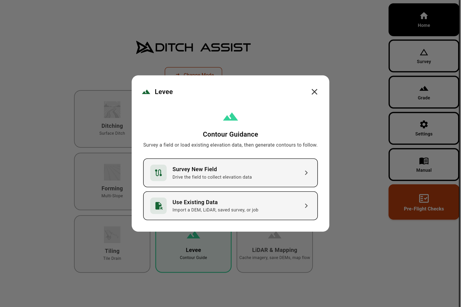


Drive it, import it, fetch LiDAR, or resume yesterday's work.
Levee guidance starts with an elevation surface. Ditch Assist can create that surface from a new driven survey, saved survey, XYZ point file, GeoTIFF DEM, public LiDAR (fetched while online, then loaded as a saved LiDAR DEM), or saved Levee job. Surveying and importing are useful on their own; generating and following contours works when the app is connected to a Ditch Assist control module or a Ditch Assist Lite receiver, or running the simulator.
Drop a benchmark, drive the field back and forth, and the app records elevation under the GPS as you go. Best when you have a clean field to drive and no existing elevation data.
Drop a drone DEM, a survey raster, or any GeoTIFF elevation file. The app reads the grid and asks the source units (meters or feet) so the contour spacing comes out correct.
Fetch public LiDAR from US 3DEP or Canadian HRDEM where coverage is available. While the tablet has internet, tap Open LiDAR & Mapping, draw the boundary, and save the DEM. Back on the machine's Wi-Fi, load it from Saved LiDAR DEM to build contours offline.
If this field was already surveyed with the tablet, pick it from the list. The app rebuilds the surface from the saved points and re-uses your benchmarks.
A plain text point file with latitude, longitude, and elevation per line. Comma, space, tab, and semicolon separators are supported. Preview the first lines, confirm columns and units, then import.
A saved job holds the elevation surface, contour settings, field boundary, active contour, and coverage. Load it later and the app rebuilds the contours and restores your progress.
Import latitude, longitude, and elevation from a simple delimited text file.
When a point file is selected, Ditch Assist previews the first rows and lets the operator set the delimiter, column mapping, header-row option, and elevation units before contours are generated. That way you can use survey data from other tools without converting it on a computer first.

If you already have a drone DEM, GeoTIFF surface, CSV/TXT point file, saved survey export, or LiDAR-derived elevation model for levee or contour generation, send us a sample before you buy. We can test it in the app and confirm whether Ditch Assist can turn it into usable contour guidance.
We look at coordinate system, units, point columns, elevation values, file size, surface density, and whether the app can generate clean contour lines from the data.
When the file imports cleanly, we can tell you what workflow fits: point-file import, GeoTIFF DEM, saved LiDAR DEM, saved survey, or a different source path.
If the data is too large, missing coordinates, using unexpected units, or exported in a format the app cannot read directly, we will look for a practical conversion or resampling path.
Once you select a contour, it turns orange on the map. The lightbar shows how far and which direction the machine is from the contour, while large map arrows point the way back. When the machine is on the line, the center blocks go green and the arrows clear out of the way.
The lightbar runs across the top of the screen. Blocks fill on the side you drifted toward, changing from green near center to yellow and red farther off. Tap the lightbar to adjust sensitivity for rough shaping or tighter finish work.
Large arrows flank the machine on the map. They point the direction to steer back to the selected contour. If the machine drifts right, the arrows point left. When the machine is on the contour, they disappear and the lightbar center goes green.
As the operator moves from one contour to another, Ditch Assist checks which line is closest and can switch the active line. On looping contours, it stays on the strand being driven instead of jumping across the field.
Same lightbar, same arrows — only the line you follow is different. Mark point A, drive a hundred feet, mark B, and the app lays evenly spaced parallel passes across the field at your swath width. Drive the nearest pass; the app auto-selects the next as you move over.
Useful for driving a clean grid while surveying a new field so the contours build off even, complete coverage, and for any time you want straight, repeatable parallel passes on the Field Survey screen.
The walkthrough also covers setting swath width, dropping benchmarks, RTK filtering, pausing and resuming, saving the survey, and exporting points for desktop design software.
Levee mode is horizontal steering help, not automatic blade control or vertical grade control. On a pull-type scraper, blade or other tractor implement, the Guidance Only Kit is enough: a Ditch Assist control module with the RTK GPS connected through it, and no valve, no plumbing, no automation install. On a dozer or self-propelled scraper, Ditch Assist Lite needs only a GPS on the blade, no wires. Both run on an Android tablet.
The Guidance Only Kit has everything Levee mode needs. Its control module talks to the tablet over Wi-Fi and passes RTK GPS data from the machine receiver for contour generation, lightbar guidance, and coverage recording. No automation valves, no hydraulic plumbing — the operator steers and works the blade hydraulics manually, eyes on the lightbar and arrows.
This is the right kit for levee, dike, contour-berm, or ridge-maintenance work on float scraper blades, paddy field implements, tractor-mounted dirt blades, and similar equipment. If the operation later needs auto-grade on other modes, add our valve and the Guidance Only Kit becomes the Full Automation Kit. Already own a compatible RTK GPS? The Guidance Only Kit works with it, on an implement or on a dozer.
The same module also supports guidance workflows across the Ditch Assist app — Ditching, Simple Grading, Land Forming, Tiling, Leveling, and Terracing — wherever on-screen on-grade feedback is enough. On an implement with a compatible factory valve, it plugs into that valve and Ditch Assist works raise/lower; contact us to confirm yours.
With the Full Automation Kit, our valve on the implement lets Ditch Assist work raise/lower in Ditching, Terracing, Land Forming, Tiling, Leveling and Simple Grading. The same control module runs Levee mode as guidance only; the valve simply isn't used while you follow a contour. Pick Levee in the wizard, generate contours, steer the line.
Grade a ditch with automatic raise/lower in the morning, then switch to Levee on the same module and top up a dike by the lightbar later in the day.
Ditch Assist Lite is guidance-only grade control for any machine or implement you can attach a GPS to, dozers and self-propelled scrapers included: only a GPS on the blade, no wires. Mount an Emlid Reach RS3 or RS4 somewhere safe where it moves up and down with the blade, and the tablet in the cab joins the receiver's own Wi-Fi. The app generates the contours and shows the same lightbar and map arrows while the operator steers and works the blade. On a tractor with a scraper or blade, Ditch Assist Lite is the lowest-cost way to run Ditch Assist, but it has no upgrade path: automatic raise/lower later means buying the Full Automation Kit at full price, with no credit for Ditch Assist Lite.
Levee mode is best at RTK Fixed accuracy for both surveying and following. RTK Float can be used for following with reduced precision at lower sensitivity settings; the app flags degraded accuracy when it happens. Bring a compatible RTK source from John Deere, Trimble, Emlid, Outback, or another standard NMEA source. On a kit, the RTK GPS must feed the Ditch Assist controller for Levee mode; a Bluetooth-only connection to the tablet is not enough. Ditch Assist Lite uses an Emlid Reach RS3 or RS4 that talks to the tablet over its own Wi-Fi.
Starting fresh? Ask about our affordable Emlid Reach RS3 or RS4 bundle — a centimeter-level RTK base and rover in one bundle, ready for the paddy, dike, and contour-guidance operator adding RTK for the first time.
A paddy dike built on a constant elevation holds an even flood. Drive the contour, build the dike on it, and hold that elevation across uneven ground without staking.
Use Levee when the job is simply to follow a constant-elevation line with manual blade control. If the job needs a designed terrace channel, berm-height check, and cut/fill balance, use Terracing mode.
Levees that follow a constant elevation across uneven ground are difficult to stake by eye. Generate the contour from elevation data, drive it once, and the line is kept in the saved job.
Conservation contractors and SWCD teams shaping ridges, swales, and contour berms across a landscape they don't own. Where public LiDAR coverage is available, they can download the area, generate contours, and drive. On a dozer, Ditch Assist Lite runs Levee with only a GPS on the blade, no wires.
Smooth or land-plane along the natural contours of a field — for finish work or to even out a rough surface before another pass. The coverage map shows where you've been across multiple days.
No more walking the field with a level and a roll of flags. Generate the contours on the tablet, pick the one you want, and follow the lightbar to keep the machine on it. Save the job and the lines are there the next day.

Operators who need RTK steering guidance to follow a constant-elevation contour — rice levees, paddy dikes, contour berms, conservation ridges, and existing ridge top-up — while keeping the blade in their own hands.
Operators who need automatic hydraulic blade control or vertical grade control. Levee mode is horizontal steering guidance only — use Ditching, Terracing, Land Forming, Simple Grading, or Leveling mode with the Full Automation Kit for automated raise/lower grade control.
Answers for operators looking at RTK contour steering, rice levee guidance, contour-ridge layout, and public LiDAR workflows.
It draws true elevation contours from a field surface, lets you select one, and provides horizontal steering guidance along that constant-elevation line with a lightbar and on-map arrows.
No. Levee is horizontal guidance only. The operator steers and controls the blade manually. It does not automate hydraulics or provide vertical grade control. Use Ditching, Terracing, Land Forming, Simple Grading, or Leveling with the Full Automation Kit when you want automatic raise/lower control.
No. With a kit, the RTK GPS must connect through the Ditch Assist control module; the Guidance Only Kit is enough. On a dozer or self-propelled scraper, Ditch Assist Lite needs only a GPS on the blade, no wires: the tablet joins the Wi-Fi of an Emlid Reach RS3 or RS4. Either way, no automation valve or hydraulic plumbing is required.
Yes. Import a GeoTIFF DEM, import an XYZ point file, use a saved survey, drive a new survey, or fetch public LiDAR where US 3DEP or Canadian HRDEM coverage is available. Very large GeoTIFFs should be resampled first; one to three meter resolution is usually a practical target.
For building or following levees accurately, use RTK Fixed. If accuracy drops, the app warns that guidance may be less reliable so the operator can slow down or wait for the fix to recover.
They are separate modes. Use Levee for steering along a contour with manual blade control. Use Terracing when Ditch Assist should design and grade a channel plus berm. Use Land Forming for imported 3D design surfaces.
The Guidance Only Kit runs Levee guidance and on-screen guidance across the rest of the Ditch Assist app. Add our valve when you want Ditch Assist to drive the hydraulics automatically in grading modes — the Guidance Only Kit then becomes the Full Automation Kit. No per-mode activation: drive a paddy dike in the morning, survey a drainage ditch in the afternoon, switch to Terracing mode for a channel-and-berm job next week — same tablet, same operator. Ditch Assist Lite runs every one of these modes too, Tiling and Land Forming included, as guidance: you work the controls. It has no upgrade path: automating later means buying the Full Automation Kit at full price, with no credit for Ditch Assist Lite.
Surface drainage — survey, design with Slope-IQ™, auto-grade pass by pass.
See Ditching → Mode 02Cut a channel, build a berm. Wide-base farmable terraces with balanced cut and fill.
See Terracing → Mode 03Variable-slope and all-way designs from Geo-Surface™ and other popular land-forming design software, via AGD, LandXML or XYZP.
See Land Forming → Mode 04Hold a single slope or a sloped plane for roads, approaches, shallow drains and pads. Enter the grade and go, or survey first to see cut and fill.
See Simple Grading → Mode 05Sub-surface tile drainage with Tile-Best-Fit and Automatic Rock Hit Recovery.
See Tiling → Mode 06Flat pads for grain bins, machine sheds, riding arenas, and equipment yards.
See Leveling →

Add the Ditch Assist DIG™ Kit, a separate excavator kit, for bucket-tip elevation, trench design, and dug-earth mapping. It runs in the same Ditch Assist app, so there is no second app to learn.
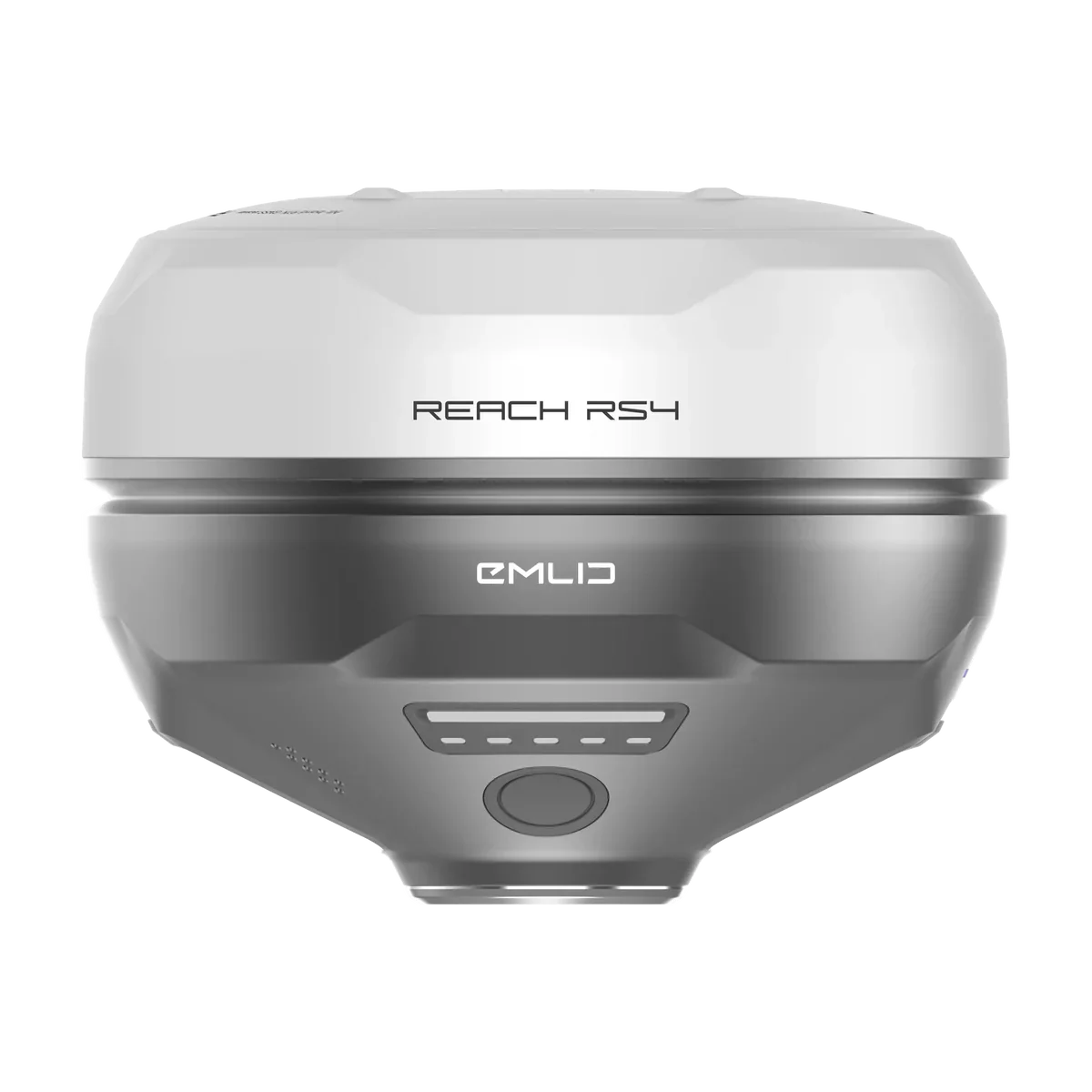
Levee mode depends on a clean elevation surface and stable machine position while you steer the line. Existing RTK works, or Ditch Assist can quote an Emlid RS4 / RS3 base-rover bundle with the Ditch Assist-specific RTK cable, base tripod, tripod extender, and mount hardware. Ditch Assist Lite needs only a GPS on the implement, no wires: an Emlid Reach RS3 or RS4 on the machine. RTK corrections usually come from a second Reach as a base, or from a correction network over the receiver’s SIM.
Try the Levee & Contour workflow yourself: contour generation and lightbar steering, all in your browser.