Popular design software
Import surfaces from well-known land-forming and land-leveling design software through AGD, LandXML, or compatible surface exports supplied by your designer.
Ditch Assist turns centimeter-level RTK positioning into grade control and guidance for field machines — one kit, one Android tablet, any compatible RTK source. Land Forming is an included workflow. Buy the kit for this job and every other implement workflow comes with it — surface drainage, terraces, tile drainage, single-grade work, levees, leveling — at no extra cost, no per-mode activation. Land Forming runs on the Full Automation Kit, the Guidance Only Kit, and Ditch Assist Lite, which puts only a GPS on the blade, no wires, on any machine or implement, and runs Land Forming as guidance: you work the blade, and Auto-Nudge™ sets each pass’s target.
3D land forming fits the grade to the field instead of holding one plane across it. A variable-slope surface moves less dirt, keeps the productive topsoil where it belongs, and sheds water to the outlets your designer picked.
Ditch Assist implements 3D land-forming and land-leveling designs every day across North, Central, and South America. Import from Geo-Surface, other popular land-forming design software, or your specialist designer in AGD, LandXML, or our native XYZP format. Ditch Assist processes the surface, sets it as your grading target, and builds a high-resolution cut/fill map — coverage fills in on the map as you work.
This is the in-app workflow an operator follows in the field: check module and RTK GPS status, set swath width for coverage, switch Land Forming to metric, import the 3D design file, generate the cut/fill map, calibrate GPS elevation to a benchmark or unchanged area, enable Auto-Nudge, then grade the surface with RTK control and live coverage feedback.
Set swath width, confirm metric units, select the AGD, LandXML, or XYZP file from the tablet, then let Ditch Assist build the design surface and cut/fill map.
Use an imported benchmark or an unchanged green area on the cut/fill map so the current RTK setup matches the original survey elevation.
Run Auto-Nudge for deeper cuts, use Hold for manual guidance, watch color-coded coverage, then resume the saved job later if the field is not finished in one session.
This walkthrough simulates the full advanced 3D Land Forming flow in the Ditch Assist app, matching what an operator does when importing and implementing a variable-slope design surface.
The setup walkthrough covers the app and machine checks that should happen before importing or implementing a variable-slope land-forming surface.

Land forming starts with the surface your designer created. Ditch Assist focuses on execution: import the design, lock it to the field with a benchmark, then drive the implement to the 3D target.
Import surfaces from well-known land-forming and land-leveling design software through AGD, LandXML, or compatible surface exports supplied by your designer.
Geo-Surface.com builds simple land-forming designs and exports them ready for Ditch Assist. Filling in low areas and grading the entire field to the outer bounds? It is the fast, affordable way to get that design done.
Ditch Assist works with designs from land grading software such as Ezigrade: bring them in through AGD/Agguide, LandXML, or XYZ/XYZP handoff paths.
Import AGD designs and use embedded benchmark information where available, then drive to the benchmark and calibrate in the cab.
Use LandXML when your designer, civil package, or land-forming workflow exports a surface that needs to run on field equipment.
Use Ditch Assist’s native XYZ/XYZP text format for straightforward surface handoffs from custom workflows or specialist designers.
Once the file is processed, the tablet shows the target surface, cut/fill map, benchmark calibration, and live coverage as you grade.
One plane is the right call when the job really is flat or one constant slope — Ditch Assist runs those in Leveling and Simple Grading. Whole-field drainage is different: the best design often changes slope across the field so water leaves without moving more soil than necessary.
That is where Land Forming fits. Your designer builds the variable 3D surface in popular land-forming design software such as Geo-Surface, or in another design workflow; Ditch Assist turns that surface into the in-cab grade target.
Leveling is for one elevation: pads, yards, sheds, arenas, and bins.
Simple Grading is for one slope across the job.
Land Forming is for a variable 3D design that drains the field while limiting dirt moved.
Import the design, calibrate to a benchmark, then auto-grade. The cut/fill map fills in as you cut — green where you’ve reached grade, gradients elsewhere showing exactly how much material is left to move and where it goes.
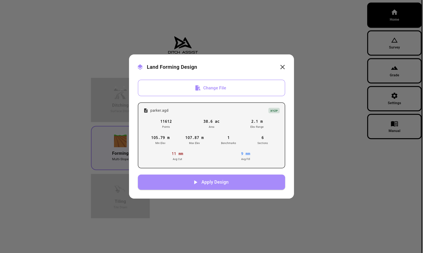


Once the import is processed, the Land Forming screen shows your design as a high-resolution cut/fill map — colour gradients tell you exactly where to move material and how much. Tap Start and the implement begins following the design.

When the design calls for more cut than one pass can take, Ditch Assist stages the depth across passes, each one held to the max cut you set. This feature is called Auto-Nudge.
A land-forming design rarely cuts evenly across the field — some areas may only need a few centimetres, others 30 cm or more. Auto-Nudge™ stages those deeper areas pass by pass, sized to what your tractor and scraper can pull. Set your max cut per pass; the system limits target depth across the whole surface and you advance when each pass is complete.
Configure the deepest single-pass cut your scraper and conditions can handle. Auto-Nudge™ respects that limit everywhere on the field, even where the design calls for the heaviest cuts.
Auto-Nudge™ computes the target surface for the current pass — never more than your max below the current ground. The cut/fill map shows what’s been graded and what’s still pending, so you can see the field filling toward final grade.
After covering the field, tap Pass + in the sidebar. The system sets the next target, the cut/fill map updates, and you keep grading until the entire field is on final grade.
Land-forming jobs run mostly on land levelers and hydraulic blades, which cut and fill to the 3D design and finish the surface. Pull-type scrapers do the bulk earth moving when the design shifts a lot of soil from high spots to low. On all of them we recommend the Full Automation Kit: our valve on the implement, and Ditch Assist works raise/lower to the 3D design. Pick yours below for setup and compatibility details.
On a 3D land-forming job, a land leveler’s broad cut and even weight smooth the surface in fewer passes than a typical blade, and its long wheelbase holds a steady line under automatic raise/lower. The Full Automation Kit adds our valve to any hydraulic land leveler, and Ditch Assist works raise/lower to the 3D design. The Guidance Only Kit shows the cut/fill on screen while you work the hydraulics yourself, following the arrows, and you can add our valve later to make it the Full Automation Kit.
Ditch Assist works with the raise/lower function only. Tilt and side-wing functions stay manually operated. For tilt-capable units, keep the tilt angle constant from setup through to grading — changing it mid-job shifts the GPS height offset and pulls the leveler off the design.
Auto-Nudge™ splits the deepest cuts into passes no deeper than the max cut you set, and the cut/fill map shows what’s left to move at all times.
The control module talks to the tablet over Wi-Fi, so no harness goes through the cab door and the kit moves quickly between machines. Works with any compatible RTK GPS; the Emlid Reach RS3 or RS4 is our affordable starter option.
Hydraulic blades and pull-type dozer blades give you tight depth control, low ground pressure, and the manoeuvrability to work the slope changes in a 3D design. The Full Automation Kit and the Guidance Only Kit both fit any hydraulic blade, pull-type dozer blades included.
The Full Automation Kit adds our PWM valve, hoses, fittings, and a manual-bypass circuit, and Ditch Assist works raise/lower to the design. The Guidance Only Kit is the control module and harness only, no plumbing: you work raise/lower yourself following the arrows on the screen, and can add our valve later to make it the Full Automation Kit.
Either way, Ditch Assist works with the raise/lower function only — tilt and side-wing functions stay manual. Keep the tilt angle constant from initial setup through to grading; changing it alters the GPS height offset and pulls the blade off the design.
Auto-Nudge™ stages the deepest passes to the max cut you set, sized to what the blade and tractor can handle. The cut/fill map fills in as you work.
Wi-Fi from the control module keeps cab wiring minimal and allows fast machine swaps. Works with any compatible RTK GPS; ask about the affordable Emlid Reach RS3 or RS4 bundle.
Pull-type scrapers do the bulk earth moving in land forming, when the design shifts large volumes from high spots to low. The Full Automation Kit adds our valve to any hydraulically operated pull-type scraper, and Ditch Assist works raise/lower to the 3D design. Rather work raise/lower yourself? The Guidance Only Kit shows the cut/fill on screen while you work the existing hydraulics, following the arrows, and you can add our valve later to make it the Full Automation Kit.
Many operators run a scraper for the bulk earth moves, then switch to a blade or land leveler to finish — the same kit moves between both in as little as 20 minutes. Min Valve DC and Max Valve DC (duty cycle) settings in the app let you tune hydraulic responsiveness to your scraper size; high-flow valve spool upgrades are available for extra-large scrapers.
Auto-Nudge™ stages deep cuts to the max cut you set, even in the heaviest areas of the design. The cut/fill map fills in as you go, so progress is always visible.
Ditch Assist works with any compatible RTK GPS. Starting without RTK? Ask about the affordable, reliable Emlid Reach RS3 or RS4.
Whichever kit you buy for land forming — Full Automation or Guidance Only — unlocks every other implement workflow in the Ditch Assist app. No extra cost, no per-mode activation. Same kit, same tablet, same operator.
Surface drainage runs — survey, design, auto-grade. Curved, multi-grade, kilometre-long.
See Ditching → Mode 02Simple Maintenance uses one survey. Standard Terracing keeps channel + berm surveys for construction.
See Terracing → Mode 04Single-slope grading or a sloped plane: type a grade percent and go, or survey a centerline first and fit one grade to the ground.
See Simple Grading → Mode 05Sub-surface tile drainage with depth-constrained design and Automatic Rock Hit Recovery.
See Tiling → Mode 06Flat pads for grain bins, machine sheds, riding arenas, and equipment yards.
See Leveling → Mode 07Drive elevation contours for levees, paddy dikes, and contour berms — lightbar guidance with no automation valve or hydraulic plumbing.
See Levee →Operators running a land leveler, hydraulic blade, pull-type dozer blade, or pull-type scraper who have — or can get — a 3D land-forming design in AGD, LandXML, or XYZP and want RTK grade control to put it on the ground. On a dozer or self-propelled scraper, Ditch Assist Lite runs Land Forming as guidance.
A single flat pad with one target elevation — see Leveling. A single-slope job with no imported 3D design — see Simple Grading. Excavator bucket guidance — see Excavator and DIG™.
These are the questions operators and designers usually ask when they want to turn a 3D land-forming or land-leveling design into finished ground.
Yes. Ditch Assist can run surfaces from popular land-forming and land-leveling design software through supported design handoff formats such as AGD, LandXML, and compatible XYZ/XYZP surface exports. Once imported, the tablet builds the grading target and cut/fill map for field execution.
Use Geo-Surface.com. It builds simple land-forming designs and exports them ready for Ditch Assist — the fast, affordable way to fill in low areas and grade the entire field to the outer bounds. For complex designs, work with your designer or popular land-forming design software.
AGD when it can. Most land-forming software can create an AGD file, and it carries the grade points, benchmarks, and balance-section boundaries in one file. Use LandXML or XYZ/XYZP when that is the clean export path.
When benchmark information is present, Ditch Assist turns it into a drive-to calibration target. Drive to the benchmark, tap Calibrate, and the imported surface is locked to the field before grading starts.
Yes. LandXML is a common way to move surface data between design software and field systems. Ditch Assist imports supported LandXML surfaces and turns them into the same in-cab grading target and cut/fill map.
XYZ and XYZP are Ditch Assist’s native point-file formats for simple surface handoffs. XYZ rows are latitude, longitude, and existing elevation; XYZP adds a fourth column for proposed elevation, which unlocks cut/fill, volume summaries, and Auto-Nudge™ pass staging. Rows can be comma, tab, or whitespace delimited, and the file should contain numeric rows only — no header row.
Most operators use land levelers, hydraulic blades, pull-type dozer blades, and pull-type scrapers. On those, the Full Automation Kit adds our valve and Ditch Assist works raise/lower to the design. With the Guidance Only Kit you work raise/lower yourself following the arrows on the screen, and can add our valve later. Ditch Assist Lite runs Land Forming as guidance on any machine you can put a GPS on, dozers and self-propelled scrapers included: only a GPS on the blade, no wires, and you work the blade while Auto-Nudge™ sets each pass’s target. Already own a compatible RTK GPS? Ask us about the Guidance Only Kit instead; we review each machine first.
Yes. Ditch Assist works with any RTK GPS that can provide position data to the tablet and control module. Many customers bring their existing RTK source; others start with an affordable Emlid Reach RS3 or RS4 bundle.
Ask your designer or software to export an AGD file when possible. AGD is the preferred handoff because most land-forming software can create it, it is widely used, and it can carry grade points, benchmarks, and balance-section boundaries in one file. Copy the design onto the Android tablet, then open Land Forming → Import AGD File (or Import XYZP File / Import LandXML).
Set the Ditch Assist app to Metric before importing or running a Land Forming design. Design elevations, benchmark calibration, cut/fill values, and 3D surface calculations are handled in metric units for this mode.
Choose AGD when available; use LandXML or XYZP when that is the clean export path.
Use Downloads, Documents, USB storage, or a synced folder.
Review points, area, benchmarks, sections, and cut/fill.
Calibrate to the BM, then let the cut/fill map guide the job.
Use AGD when you can. It is the most universal Ditch Assist handoff because most land-forming design software can create it and it keeps the design surface, benchmarks, and balance sections together. Ditch Assist recognizes AGD when the first row includes Existing, Proposed, and Code. Keep it comma-delimited and leave blank cells in place where the format requires them.
Latitude, longitude, existing elevation in meters, proposed elevation in meters, cut/fill, code, comments.
Latitude (deg), Longitude (deg), Elevation Existing(m), Elevation Proposed(m), CutFill(m), Code, Comments
49.123456,-97.654321,246.82,245.96,0.86,3GRD,
49.123900,-97.654900,246.50,246.50,0.00,0MB,Main BM
49.124500,-97.655500,,,,2BAL1,North section
3GRD rows are the grade points used to build the 3D surface.0MB rows become imported benchmarks. The app uses the existing elevation as the known surveyed ground elevation, lists the BM in the calibration dialog, and lets the operator drive to it for a 5-second GPS calibration.2BAL{n} rows become balance-section boundaries drawn as dotted loops on the map. They help the operator finish one section before moving to the next.Use XYZ or XYZP for simple point handoffs, custom exports, or software workflows that do not export a clean AGD file. Use decimal WGS84 latitude and longitude; if your export is easting/northing, convert it first or use LandXML with a coordinate system.
XYZ: latitude, longitude, existing elevation. XYZP: latitude, longitude, existing elevation, proposed elevation. Use numeric rows only: no headers.
49.123456,-97.654321,246.8249.123456,-97.654321,246.82,245.96Delimiter: comma, tab, or whitespace are accepted for XYZ/XYZP. Every row should start with numbers. XYZP includes the proposed grade in the fourth column, which allows cut/fill, volume summaries, and Auto-Nudge™ pass staging.
Use LandXML for Civil 3D, Trimble Business Center, and other civil/survey exports. The file should contain at least one <Surface> with TIN points and faces.
<P id="1">5543210.23 612345.67 246.82</P>
<F>1 2 3</F>Before heading to the field, put the design file somewhere the tablet file picker can reach: Downloads, Documents, USB storage, or a shared folder synced onto the device.
If your designer, surveyor, or software has already produced a land-forming surface, send us the export before you buy. We can test the handoff, confirm whether Ditch Assist can load it, and flag any format, coordinate, unit, benchmark, or file-size issues while there is still time to fix them.
Send the exact design export you expect to use in the field, plus any benchmark notes, units, coordinate system information, and the software or designer it came from.
We check whether the file imports, whether the surface and cut/fill map make sense, whether benchmarks are usable, and whether the design is too dense for practical field use.
If the design does not load cleanly, we will look for the practical fix: a different export, simplification, coordinate-system correction, unit cleanup, or conversion through a better handoff format.


Add the Ditch Assist DIG™ Kit, a separate kit for excavators and backhoes: bucket-tip elevation, trench design, and dug-earth mapping. It runs in Excavator mode of the same Ditch Assist app you use on the implement.
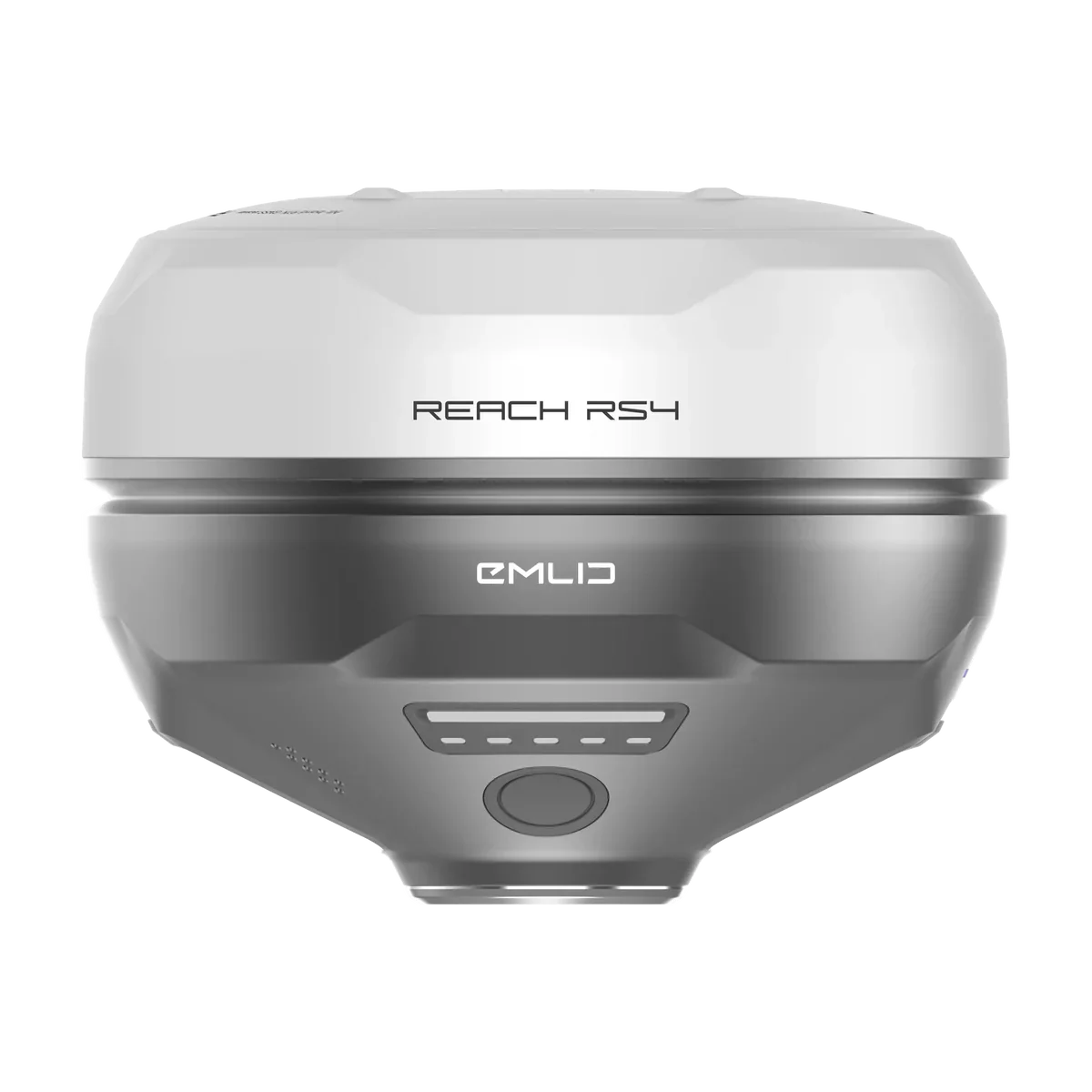
Land Forming needs stable RTK height for benchmark calibration, live cut/fill maps, and grading to the imported design surface. Bring your existing receiver, or quote Emlid RS4 / RS3 receivers with Ditch Assist when you want an affordable base-rover setup. The Ditch Assist-only bundle can include the tripod, extender, mounts, and Emlid RTK GPS cable needed for the machine.
Try the Land Forming workflow yourself: design import, benchmark calibration, and cut/fill grading, all in your browser.