Component 01
IP67 stick + bucket sensors
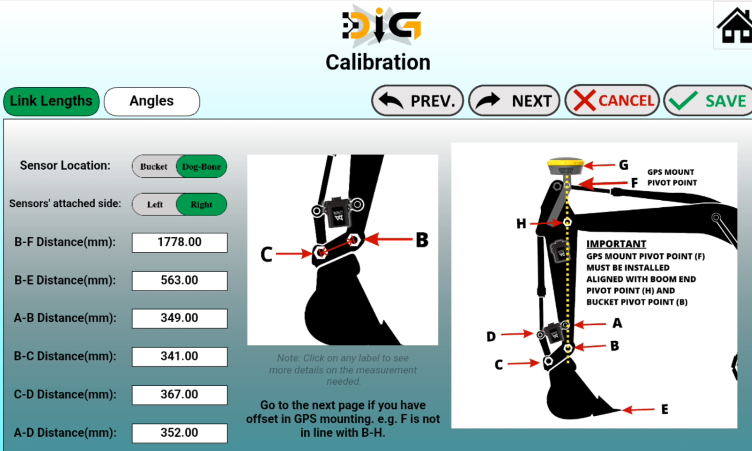
Sealed inclination sensors mount to the stick and bucket or dogbone linkage and track the geometry needed to calculate cutting-edge grade.
Field-proven since 2014 · Trusted in 15+ countries · Engineered & manufactured in Manitoba, Canada
DIG™ is guidance, not hydraulic automation. The operator stays in control of the machine while the app shows the cutting edge against grade in real time.
Component 01
Sealed inclination sensors mount to the stick and bucket or dogbone linkage and track the geometry needed to calculate cutting-edge grade.
Component 02
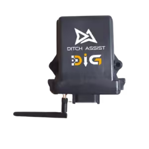
The DIG™ module connects sensors, RTK/GNSS position, and the Ditch Assist app so the cab display can show high, low, and on-grade feedback.
Component 03
Included with the kit. The pendulum mount keeps the GPS receiver level through changing boom and bucket positions, helping position stay reliable while digging.
Component 04
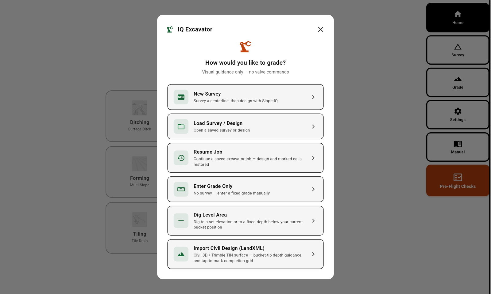
Bring a compatible receiver or quote Emlid base-rover GNSS. The Android app is the operator screen for grade, level, Slope-IQ™, LandXML, recording, and resume.
Excavator and backhoe operators who want RTK bucket-to-grade guidance for farm drainage outlet work, ditch cleanup, culverts, small earthworks, pads, and slopes — without installing hydraulic automation on the machine.
Operators who need the excavator's hydraulics automated for them, or a full civil machine-control platform built for large-scale construction work. For hydraulic automation on implements, see the Ditch Assist Automation Kit.
Excavator guidance depends on knowing where the cutting edge is in 3D space. DIG™ includes a pendulum-style GPS mount so the receiver can stay level as the boom, stick, and bucket move through normal digging positions.
The counterbalanced mount helps avoid extreme receiver tilt as the stick reaches, curls, and returns.
The GPS pivot point is measured as part of setup, and small horizontal offsets can be entered when perfect alignment is not practical on a specific machine.
The tube, flange, bolt, washer stack, grease point, and counterbalance plate are designed for real excavator installation, inspection, and maintenance.
The DIG™ stick and bucket sensors are IP67 rated, and the protective mount housings add a physical shield around the installed sensors. The goal is simple: keep the critical angle sensors visible, serviceable, repeatable, and better protected on machines that work in dirt every day.
DIG™ combines sensor angle data with RTK position and machine measurements so the app can calculate the cutting edge location.
Once the sensor brackets are installed on a machine, the system can be calibrated, saved, and recalled later as a machine profile.
The installed housings keep the sensors accessible so operators can check hardware, cable exit, and mounting condition during normal pre-use checks.
DIG™ setup records the machine measurements and calibrates the stick and bucket sensors so the app knows where the cutting edge is. Once a machine is calibrated, save the profile and recall it later.
Weld or mount the brackets so sensor positions are repeatable on each machine.
The setup process records machine geometry and sensor positions for accurate bucket guidance.
Move the kit between prepared machines and recall the saved profile instead of starting over.
After setup, operators use Excavator mode in the Ditch Assist app for the actual field work.
If the machines have fixed sensor brackets installed and saved profiles, moving DIG™ is much simpler. Mount the sensors and receiver, select the matching profile, verify setup, and start work in the app.
Sensor brackets are installed on each excavator or backhoe so the sensor position is repeatable every time.
Store up to 10 calibrated machine profiles so the operator does not re-enter measurements for every move.
After moving the kit, confirm the selected profile, sensor status, RTK position, and bucket reference before grade work starts.
DIG™ works with RTK GPS from virtually any manufacturer, so you can keep the equipment you already own or choose the solution that fits your budget. No proprietary lock-ins. If you do not currently have RTK, we offer simple, cost-effective options to get started without high price tags or confusing setup.
Our team helps you pick the right solution for your needs, whether you are new to GPS or already running RTK on other equipment.
For survey work, take the Emlid rover off the excavator, mount it on an ATV or UTV, and drive the route while the Ditch Assist app records the survey over Bluetooth.
Use the survey in the Ditch Assist app to design the ditch or trench with Best-Fit, Guided, or Freeform tools.
Return the rover to the machine, open the saved design, and dig with live bucket guidance in the app.
Use DIG™ on full-size excavators, mini excavators, wheeled excavators, long-reach machines, and backhoes. Long-reach excavators are usually a fit but may require CAN sensor cable extensions. If the machine has a stick and bucket, ask us about the mounting path.
Operators researching systems such as Trimble Earthworks, Leica iCON, Topcon 3D-MC, or MOBA Xsite are usually comparing broader civil machine-control platforms. DIG™ is a simpler, more affordable RTK bucket-guidance product built specifically for Ditch Assist workflows — not a claim-for-claim replacement for those systems.
|
Ditch Assist DIG™
For excavators + backhoes
|
Ditch Assist implement kit
For pull-type + mounted implements
|
Full civil machine control
e.g. Trimble Earthworks, Leica iCON, Topcon 3D-MC, MOBA Xsite
|
|
|---|---|---|---|
| Machine type | Excavators and backhoes | Pull-type and tractor-mounted implements — scrapers, ditchers, tile plows, blades, land levelers | Excavators, dozers, graders, and other civil construction machines, depending on the platform |
| Hydraulic automation | None — guidance only, operator runs the bucket | Automatic with the Full Automation Kit, or guidance only with the Guidance Only Kit | Often included on the host machine, depending on the specific platform and package |
| Sensors + position | IP67 stick and bucket inclination sensors, RTK/GNSS position, GPS pendulum mount | Control module with RTK/GNSS position, plus a proportional hydraulic valve on the Full Automation Kit | Platform-specific sensor and valve packages integrated into the machine |
| App / display | Ditch Assist Android app — same app used across every Ditch Assist mode | Ditch Assist Android app | Proprietary in-cab displays specific to each platform |
| Design file import | Slope-IQ™, LandXML, and the same import workflows as the rest of the Ditch Assist app | Slope-IQ™, AGD, OptiSurface™, Ezigrade™, Topcon™ AGForm-3D™, and LandXML | Platform-specific design workflows; typically supports common civil file formats |
| Typical use | Farm drainage outlet work, ditch cleanup, culverts, small earthworks, pads, and slopes | Farm drainage, tiling, terracing, land forming, and leveling | Full-scale civil construction and earthmoving projects |
| Subscription | None — one-time purchase | None — one-time purchase | Varies by platform |
Comparing DIG™ with lower-cost 3D guidance kits such as the FJD Trion G31? Both put bucket position on a screen — so compare the software. DIG runs the complete Ditch Assist app on a standard Android tablet: Slope-IQ™ ditch and trench design, route survey, saved machine profiles, and the same design files and modes used across every Ditch Assist machine. One app to learn, one RTK source shared with the implement kits, no subscription.
Trimble Earthworks, Leica iCON, Topcon 3D-MC, MOBA Xsite, and FJD Trion G31 are named only as examples of systems buyers may also research. Mentioning them does not imply affiliation, endorsement, or equivalence.
DIG™ was built by drainage people — and the same bucket-to-grade guidance covers the dirt work around it. If the job has a target elevation, DIG™ puts it on the screen.
Hold depth to grade for water, sewer, and utility runs — nobody standing in the trench with a grade rod.
Dig to the spec elevation and stop before overdig — no re-fill, no re-compaction, no extra concrete.
Set invert elevations on both ends and cut the fall between them without repeated checks.
Survey the route, design the fall with Slope-IQ™, and dig long runs — curves included.
Level areas to one target elevation with the same app — pads, ponds, and flat cuts.
Tell us the excavator or backhoe and the work you do.
Once DIG™ is installed and calibrated, the operator can use the app for quick grade checks, level areas, Slope-IQ™ trench design, LandXML surfaces, job progress, and resume. The target stays in the cab, where the digging decisions happen.
Compatibility, machine profiles, RTK input, and what DIG does not automate.
Yes. DIG works with RTK GPS from virtually any manufacturer that can provide compatible position data. If you do not already have RTK, an affordable Emlid GNSS bundle can be added to the quote.
DIG is guidance only. It does not automate excavator hydraulics. The operator stays in full control of the machine while the app shows the cutting edge against grade in real time.
Yes. DIG can save up to 10 calibrated machine profiles, so the kit can move between prepared excavators and backhoes without re-entering measurements.
DIG is used on full-size excavators, mini excavators, wheeled excavators, long-reach excavators, and backhoes. Long-reach machines are usually a fit but may need CAN sensor cable extensions.
DIG is a simpler RTK bucket-guidance product built for Ditch Assist workflows. It is not a claim-for-claim replacement for full civil machine-control platforms such as Trimble Earthworks, Leica iCON, Topcon 3D-MC, or MOBA Xsite, which typically add hydraulic automation and broader civil design workflows.
No. DIG is a one-time hardware purchase with no app subscription and no per-mode activation.
Yes. DIG and the Ditch Assist implement kits are separate hardware that can run on different machines at the same time, sharing one RTK base station.
The FJD Trion G31 is a 3D excavator guidance system with its own in-cab display. DIG™ takes a different approach: it runs the complete Ditch Assist app on a standard Android tablet — Slope-IQ™ design, route survey, saved machine profiles — and shares one app and one RTK source with the Ditch Assist implement kits. Weigh the display, the design workflow, RTK flexibility, and total cost across your machines.
A one-year technology warranty — anything defective that fails in normal use gets repaired or replaced. After the warranty period, our out-of-warranty replacement program supplies new modules, sensors, and other components at a significantly discounted price.
The hardware pairs with the same Ditch Assist app you can try right now in your browser — no login, no install, no hardware required.