Two questions get answered every time you plan drainage work. Where does the water want to go? And where does it stop along the way? The eye can't read either one from the cab. A walk through at green-up gets you closer but costs a day, and you still miss the closed depressions that dry down before they leave a visible mark.
Where public LiDAR is currently available, LiDAR Drainage Mapping answers both from a polygon you draw in the app or a boundary you draw or import in the Ditch Assist owner portal on Geo-Surface. The cloud pulls the available elevation data, runs flow-accumulation, ponding-fill, and depression-detection passes, then returns drainage layers for field planning.
In the app, generated layers save to the tablet under your survey, design, and grading workflows. In Geo-Surface, owners can map from the office and export geo-referenced references. Access and coverage depend on the current service and third-party public datasets, so build your priority-field library now while data is available.
Currently included for owners, but it is a planning layer, not a survey replacement. Check source coverage before the job and know what it is built for before you rely on it in the field.
Seeing flow, ponding, and depression patterns before you commit a route — for ditching, tiling, land forming, or leveling — from the tablet in the field or the office on Geo-Surface.
Certified as-built elevation or legal survey work. LiDAR Drainage Mapping is built from public LiDAR archives — drive your own RTK survey in the app when the job needs verified ground truth.
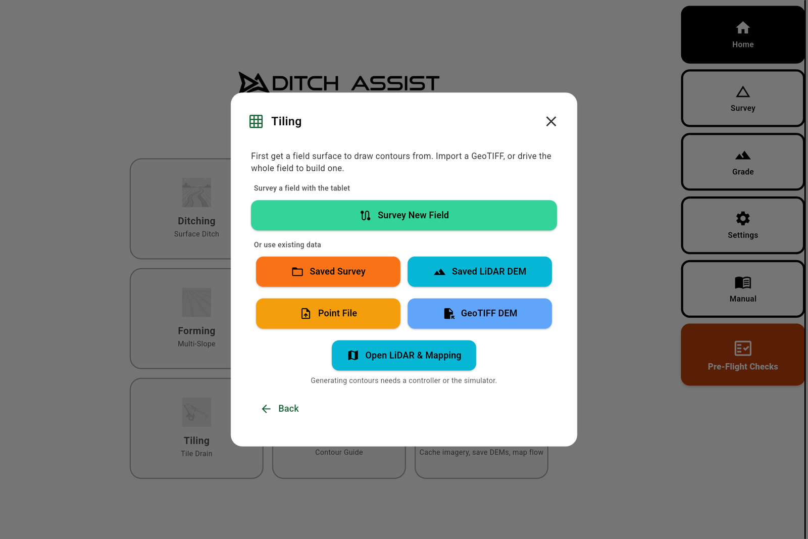
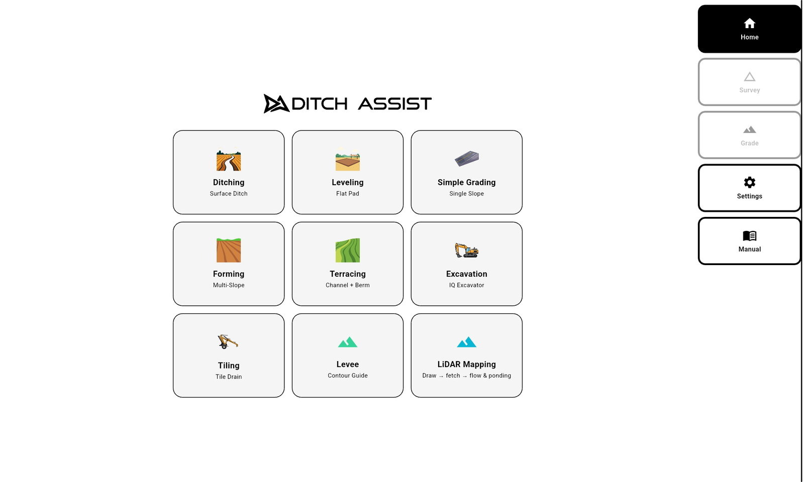
Tap the LiDAR Mapping card on the Home screen, draw the field on the in-app map, hit Generate. Up to 800 acres per fetch — bigger than any field most operators run.
Tap the map to drop corners around the field. Undo removes the last point, Clear starts over. Three corners and the Generate button activates. Drop more for a tight polygon along an irregular boundary.
Tap Generate, name the field, wait roughly thirty seconds. The app fetches LiDAR, picks an appropriate resolution for the polygon size, ships it to the processor, pulls back the finished layers — all from the tablet.
Tap Done. Flow, ponding, and depression layers appear on the map and the LiDAR Mapping workflow auto-clears. Switch into Ditching, Tiling, or Land Forming — the layers stay under your survey, design, and grading screens.
Ditch Assist owners currently receive complimentary access to an exclusive drainage mapping portal on Geo-Surface.com. Geo-Surface is an independent venture created by Simon Knutson — founder of Northern Plains Drainage Systems (NPDS) and creator of Ditch Assist. That shared origin makes this unusually capable planning portal available to Ditch Assist owners at no additional cost today.
Locate each field, draw or import its boundary, and fetch the best public LiDAR available for that location.
Read elevations, compare ponding and true depressions, adjust ponding sensitivity, and show major or minor flow paths.
Use the map to focus the first RTK survey, then export a Ditch Assist image and matching world file as a geo-referenced overlay.
This walkthrough shows the complete office-planning workflow available to Ditch Assist owners through the complimentary Geo-Surface portal. The app shown is the legacy version; the current app can now generate LiDAR drainage layers directly after owner hardware has been connected.
Start with a field boundary in the portal. Draw it directly, or import an existing boundary when the field is already mapped.
Fetch public LiDAR, then generate flow maps, depressions, and ponding layers like the in-app workflow.
Export geo-referenced images from the portal and load them into the Ditch Assist app as map reference layers for field work.
Flow lines, ponding risk, depression detection. Each layer toggles independently with its own opacity. Ponding layers also expose a Cutoff slider so shallow ponding can be hidden when you only want the spots that actually matter.
The channels water already wants to follow across the field. Survey the line, design the ditch along it, and Slope-IQ™ Best-Fit has less work to do — less depth cut, less material moved, more acres drained.
The areas that hold water under modelled fill. Combine with Flow Routes to see whether a single tile run drains a whole cluster, or whether multiple runs make more sense. Drop the Cutoff slider to hide puddles that don't matter.
The closed-contour low spots — places that would pond if water reached them, whether they currently show it or not. The depressions a leveler pass takes out in an afternoon, instead of fighting the same drowned acre every wet spring.
LiDAR Drainage Mapping isn't a separate workflow you run on its own. It's the picture that makes every other workflow smarter — surface drainage, tile, land forming, leveling. Use it in the app when you are preparing the tablet for field work, or use the Geo-Surface portal when you want to review fields and save reference layers from the office.
Problem: A ditch designed without seeing the flow pattern can run uphill of where water actually wants to go — needs more depth, drains fewer acres.
Fix: Survey along the LiDAR Drainage Mapping Flow Route. Slope-IQ™ Best-Fit has less work to do because the line already follows the natural fall, and the resulting ditch reinforces the field instead of fighting it.
Problem: Tile lines placed on a satellite-photo hunch miss the depression clusters that cost yield, or trench past dry ground.
Fix: Lay the proposed run over the Ponding Risk + Depression layers. See at a glance whether one main covers the worst acres, or whether two shorter runs into a common outlet drain more for the same trench length.
Problem: A 3D land-forming design looks good on a contractor's screen, but you don't know if it targets the spots that actually pond.
Fix: Overlay the design on the LiDAR Drainage Mapping ponding layer before commissioning the work. Confirms the cut/fill plan matches the real ponding pattern — or flags a redesign before any dirt moves.
Problem: Closed depressions on otherwise-graded ground don't show on a satellite photo and rarely catch the eye on a walk-through.
Fix: The Depression layer pinpoints them. Plan a leveling pass that takes them out the next time the leveler's on the field — instead of finding them next spring when the crop drowns.
Problem: A walk through at green-up to find wet spots costs a day and you still miss the closed depressions that don't pond visibly.
Fix: Generate LiDAR Drainage Mapping the night before. Drive straight to the spots that matter, with the depression and ponding layers on the tablet, and book the work without a second trip.
Problem: After a tile run or a forming pass, you want to know whether the depressions you targeted have actually been resolved.
Fix: The LiDAR Drainage Mapping you generated still sits on the tablet. Open it under the satellite basemap and walk the spots that were marked — confirms the work, or shows what's still left to drain.
LiDAR Drainage Mapping unlocks when the tablet pairs with a Ditch Assist™ control module or Ditch Assist DIG™ kit, verifying owner hardware for current access. Owners can also use the Geo-Surface portal for office mapping, boundary imports, and geo-image exports. Because public coverage comes from third parties, check and save priority fields while it is available.
Connect the tablet to a Ditch Assist or DIG controller the way you do for any grading session. The app reads the kit's serial, marks you as the owner, and LiDAR Drainage Mapping is unlocked on that tablet.
Switch the tablet onto yard Wi-Fi, a hotspot, or LTE in the truck. Draw boundaries around every field on the operation, generate each one, and save the layers for field use.
Open the owner portal on Geo-Surface.com to draw or import boundaries, generate drainage maps, save geo-referenced images, and bring those references into the app.
Most grade-control systems don't ship drainage mapping at all — and the few products that sell anything comparable charge several dollars per acre. Ditch Assist gives owners the in-app field workflow plus the Geo-Surface office portal, so the hardware that grades the field and the picture that tells you where to grade it come together.
LiDAR Drainage Mapping runs inside the same app the operator uses for survey, design, and grade — same map, same gestures, no second tablet in the cab.
The Geo-Surface owner portal lets Ditch Assist customers draw or import boundaries, generate flow, ponding, and depression layers, and export geo-referenced images before heading to the field.
When owners need full surface design, tile design, land-forming design, the new PC version, and contractor-grade tools, the portal displays a 20% discount code for Geo-Surface Pro.
Fields you generate now are filed locally on the tablet. Toggle whole fields or individual layers, tune opacity, and hide shallow ponding without leaving the workflow you're running.
Open Saved Fields from the LiDAR Mapping sidebar — or pick My LiDAR Fields from the Map Layers dialog — and every field you've generated is there. Expand a field to toggle its Boundary, Flow Routes, Ponding Risk, and Depressions independently.
Tap Map Layers on the map. Each ponding and depression row has an expand caret — open it for the Opacity slider. Ponding layers also expose a Cutoff slider, which hides ponding shallower than the depth you set.
Generating a field auto-clears the LiDAR Mapping workflow so you can hop into Ditching, Tiling, Land Forming — the layers stay on the map under your survey, design, and grading screens. Same picture from survey to final pass.
LiDAR Drainage Mapping depends on third-party public archives that Ditch Assist does not control. Availability and resolution vary by location and can change. Check your priority boundaries in the app or Geo-Surface portal now, and generate the fields that are covered.
Every dialog, slider, and storage detail — in English, Spanish, and Brazilian Portuguese. Hand it to the operator who'll be running it.
Flow Routes, Ponding Risk, and Depressions. Flow Routes show the channels water already wants to follow. Ponding Risk shows areas that hold water under modelled fill. Depressions show closed-contour low spots that would pond even if they don't show it today.
Currently, owner access is included at no additional cost with eligible Ditch Assist™ hardware. Service and third-party public LiDAR availability apply, so check and generate priority fields while coverage is available.
The in-app workflow runs on the tablet: draw a boundary, generate, and the layers save under your survey, design, and grading screens for field use. The Geo-Surface owner portal runs the same mapping from the office — draw or import boundaries, review fields ahead of time, then export geo-referenced images and load them into the Ditch Assist app as reference layers.
Pair the tablet with a Ditch Assist™ control module or a Ditch Assist DIG™ kit, the same way you would for any grading session. The app reads the kit's serial, marks you as the owner, and LiDAR Drainage Mapping unlocks on that tablet — that pairing also unlocks Geo-Surface owner portal access.
Up to 800 acres per drawn boundary — split larger fields into adjacent fetches. Coverage depends on third-party public LiDAR datasets and varies by location. Check each boundary in the app or Geo-Surface portal and generate priority fields now where data is available.
Try the live browser build of the Ditch Assist app to see the LiDAR Drainage Mapping workflow — draw a boundary, generate layers, and explore the map, no hardware required.